

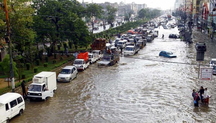
State warnings proved timely as floodwater shut Route 36 in Monmouth Beach during the nor’easter’s peak.
Story Highlights
- New Jersey declared a State of Emergency for coastal counties ahead of the storm.
- Flooding closed Route 36 at Valentine Street in Monmouth Beach on Saturday.
- Monmouth Beach saw wind gusts near 48 miles per hour and heavy rain.
- Officials urged drivers to avoid flooded roads across the Jersey Shore.
Emergency Actions And Official Warnings
New Jersey Governor Mikie Sherrill declared a State of Emergency for eight counties at 5:00 p.m. Friday. The order warned of damaging winds, heavy rain, coastal flooding, and beach erosion. The state asked residents in shore towns to prepare for road closures and dangerous surf. The timing matched forecast high tides on Saturday morning and night. These steps aimed to reduce travel and keep first responders free for urgent calls during flooding and power outages.
The National Weather Service and local media tracked a steady build in risk. Coastal flood advisories escalated to warnings for Eastern Monmouth County as water levels rose. Forecasts called for one to two feet of inundation in low areas near bays and tidal waterways. Reporters highlighted the weekend window as the most dangerous period. The message was simple and urgent: expect flooded streets, stay off risky roads, and avoid breaking surf zones along the beach.
Direct Impacts In Monmouth Beach And Nearby Towns
By Saturday, flooding closed Route 36 at the intersection with Valentine Street in Monmouth Beach. Live regional coverage repeated that both directions were shut at that point. The closure confirmed the local effect of the surge and heavy rain. The same reports cited strong gusts and widespread coastal flooding along the Jersey Shore. Emergency crews and road teams worked around high tide cycles to manage closures and keep people away from waterlogged areas.
Across the shore, officials urged drivers to turn around at flooded lanes rather than try to pass. Television crews showed shallow to moderate flooding in nearby communities. Reporters said water covered low spots and back-bay roads as tides peaked. This matched the official safety guidance that warned of impassable streets. The advice focused on the simple rule that a few inches of moving water can sweep a car off course and trap people in rising flow.
Storm Conditions, Timing, And What Comes Next
Wind and rain built through Friday night into Sunday, lining up with the forecast hazard window. Monmouth Beach recorded gusts near 48 miles per hour as the nor’easter pushed onshore flow. Monmouth and Ocean counties picked up several inches of rain over 48 hours. The combination of onshore wind, high surf, and high tides drove water into bays and streets. That cocktail created short, sharp closure windows around the tide peaks, and then slower drainage after.
NOR’EASTER SLAMS NEW JERSEY
Floodwaters swallow streets in Monmouth Beach as a powerful nor’easter pounds the Jersey Shore with coastal flooding and rough surf. Conditions are expected to improve this afternoon, but another round of rain remains possible later today.#NYI pic.twitter.com/GaJZ2MPmJd
— NewYork-Insight (@NewYork_Insight) September 27, 2026
The pattern followed what coastal planners expect in these events. Broad warnings go out early, and specific closures come later as streets flood. Records for Saturday showed that shift in real time on Route 36 in Monmouth Beach. Some gaps remain in street-by-street detail, which is common during fast storms. For residents, the lesson is steady: heed early alerts, secure property before high tide, and do not drive through water, even if it looks shallow or familiar.
Sources:
facebook.com, newjersey.news12.com, whyy.org